
Archives
Homeland resilience focus of talk
MCEER scientists report on Gulf Coast reconnaissance trips following Hurricane Katrina
By ELLEN GOLDBAUM
Contributing Editor

Entire rooms black with mold. Boats sitting in trees, miles from shore. Hospitals with windows broken—not just by the storm, but by patients and staff desperate for fresh air. City officials standing at major intersections wearing sandwich boards that said "Boil water" since there was no other way to get the word out. Enough solid waste to fill 11 World Trade Center towers.
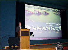
There are striking similarities between
hurricane damage and earthquake damage, says Jerome O’Connor,
pointing to a slide of a bridge damaged by Katrina and one damaged by an
earthquake
PHOTO: ELLEN GOLDBAUM
These are some of the vivid pictures that were drawn on Nov. 2 by six researchers from various disciplines who presented findings to colleagues about what they saw during reconnaissance trips to the Gulf Coast in September and October.
The seminar, "Examining Extreme Events: Hurricane Katrina's Impact on Critical Infrastructure, Societal Systems, Public Health and Environment," was held in the Center for the Arts Screening Room, North Campus.
Sponsored by UB's Multidisciplinary Center for Earthquake Engineering Research (MCEER) and supported by the National Science Foundation, the teams were dispatched first to Alabama and Mississippi, and then to New Orleans to gather the "perishable data" on the structural, societal, public health and environmental impacts of Hurricane Katrina.
They took thousands of images of affected areas, studied damaged structures and interviewed staff and officials responsible for emergency planning, environmental planning and health-care facilities.
"Every night, we'd upload our data and images to the MCEER Web site," said Gilberto Mosqueda, assistant professor of civil, structural and environmental engineering and team leader in the field.
"We wanted to get our data out to other researchers as early as possible," he said.
The goal is to enhance "homeland resilience" by designing physical structures and communities that can better withstand all kinds of disasters, earthquakes, hurricanes and terrorist attacks.
Interviews with hospital personnel who worked through the hurricane and its aftermath in New Orleans revealed that planning for a single disaster, such as a hurricane or a terrorist attack, is no longer effective.
Staff members reported that they made it through the hurricane without much damage or loss, according to Daniel B. Hess, assistant professor of architecture and planning, who conducted interviews along with Lucy Arendt, professor in the School of Business at the University of Wisconsin at Green Bay.
It was the second disaster—the flooding and the loss of power—that had a paralyzing effect.
"The back-to-back disasters led us to think about suggestions for emergency planners: Imagine the worst event possible and then double it," he said. "And don't plan for only one hazardous event."
Such advice underscores MCEER's focus on multi-hazard mitigation, which now comprises about 25 percent of its funded research.
"If you want to break the disaster-reconstruction-disaster-reconstruction cycle, you have to adopt a multi-hazard perspective," said Michel Bruneau, MCEER executive director and professor of civil, structural and environmental engineering. "It's not sufficient to respond to the 'crisis of the day.'"
During one presentation, Jerome S. O'Connor, MCEER senior program manager for transportation research, presented slides of two different bridges for audience comparison. In both, the bridge superstructures had simply dropped off their piers into the water.
One bridge had been damaged by Hurricane Katrina and the other had been damaged by an earthquake.
"You can see why we, as a center, went down to investigate because there are striking similarities between hurricane damage and earthquake damage," he said.
The flooding and loss of power impacted all sectors by:
rendering wastewater treatment plants useless.
jeopardizing severely the ability of hospitals to keep patients safe, particularly those on dialysis whose treatments require both water and power.
encouraging rapid spread of black mold, rotting thousands of wooden homes. Some engineered structures have to be stripped down to their steel frames and practically reconstructed because of the mold problem.
causing electrical utility boxes not just to short out, but to start corroding as a result of exposure to saltwater.
The researchers also wanted to find out, particularly from a public health perspective, how citizens responded to conditions resulting from the loss of power and water.
"We wanted to find out how people in a Western setting, who usually have access to water, deal with the abrupt loss of that access," said Pavani K. Ram, research assistant professor in the Department of Social and Preventive Medicine, School of Public Health and Health Professions.
She noted that if people cannot boil their water, the Environmental Protection Agency recommends that water be purified by adding just a few drops of household bleach to a gallon of water. After 30 minutes, it will be drinkable, she said.
"There may be a need to increase people's awareness of how to deal with some of these issues when the unexpected happens," she said.
Some regional characteristics led to additional wastewater issues.
According to James N. Jensen, professor of civil, structural and environmental engineering, Louisiana is home to some 20,000 wastewater treatment units owned by individual homeowners. These units also were inundated by the flood, creating environmental issues of their own.
This was in addition to the fact that some 13 million people were without drinking water after the hurricane, and even now, he said, some still don't have potable water.
To quantify the extent of structural and environmental damage, MCEER sent a team from ImageCat Inc., a California-based advanced technology company, to the Gulf Coast to conduct remote sensing and correlate satellite imagery with in-field observations.
Shubharoop Ghosh, project manager, said his team took more than 45,000 images, classifying the types of damage sustained. The images were posted to MCEER's Web site and on Google Earth.
The MCEER visits to the Gulf Coast were coordinated by Andre Filiatrault, deputy director of MCEER and professor of civil, structural and environmental engineering.
A complete webcast of the seminar may be views at http://mceer.buffalo.edu/education/webcast/Hurricane_Katrina_Seminar/Default.asp. Click on "view webcast."