
Archives
NYS geographic database opens up world of exploration
By PATRICIA DONOVAN
Contributing Editor
You're curled up in bed with three down pillows and a plush replica of Flower the meerkat when suddenly you're jerked bolt upright by the realization that you don't know how many waterfalls there are in the state of New York.
You go online. Google tells you there are 163 falls and where they are, but now you're wondering about the state's reservoirs and designated forests, and how many canals, hospitals, grassy flats, swamps, schools and streams it has, not to mention islands in St. Lawrence County.
Fortunately, Michele Shular, geosciences specialist in the Science and Engineering Library, shares your obsession.
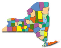
She has developed the "NYS Gazetteer and GeoData Collection," a database of digital topographical maps and gazetteer information that makes it possible to easily search and locate 38,000 places, features and other geographic sites in New York State from your laptop.
The database is free of charge and available to the public on the UB Libraries Web site.
"It permits searches to be run on geographic names, feature type, by county map, by U.S. Geological Survey quadrangle or by a merger of multiple categories," Shular says, "and has a GIS (geographical information systems) import feature that will be useful for students, technical researchers and professionals in many fields, including business, government and planning."
Hikers, backcountry skiers, snowshoers, climbers, off-road bikers, kayakers and canoers will find the maps exceptionally useful as well.
"It includes links to the appropriate feature in Google Maps," she says, "so you can locate the state's 4,961 schools, 298 hospitals, 590 towers (largely radio/TV) and 427 swamps or any of the 68 mapped streams in Erie County alone."
Schular calls topographic maps "wonderful tools that provide detailed information for natural and cultural features on the ground, such as slopes, valleys, rivers, roads and even vegetation cover.
"Whether a K-12 teacher is looking for geography class maps, or a hiker needs to print a field map, or a GIS technician requires a digital image to import into a GIS application, this database can be very useful. It serves a wide variety of needs.
"In time, it will be expanded to include maps in a variety of scales, as well as other format types of geospatial data."
Shular says the database was produced by following the lead of University of Virginia librarians, who developed a similar product.
"To produce the database," she says, "we electronically linked U.S. Geological Survey (USGS) digital maps archived at the UB Libraries with the New York State portion of the 'Geographic Names Information System, a federal repository of official domestic geographic names maintained by the USGS."
She says the digital maps available on the site are technically referred to as "geo-referenced digital raster graphics (DRGs)" and can be printed for class or fieldwork, or imported into GIS applications.
"For example," she says, "DRG topographic maps can be combined with other geospatial data, such as digital elevation models, to enhance terrain and slope visualizations useful for site planning, land management, and earth science studies.
Anyone with questions or needing assistance with the NYS Gazetteer and GeoData Collection can contact Shular at mshular@buffalo.edu or at 645-2947, ext. 223.